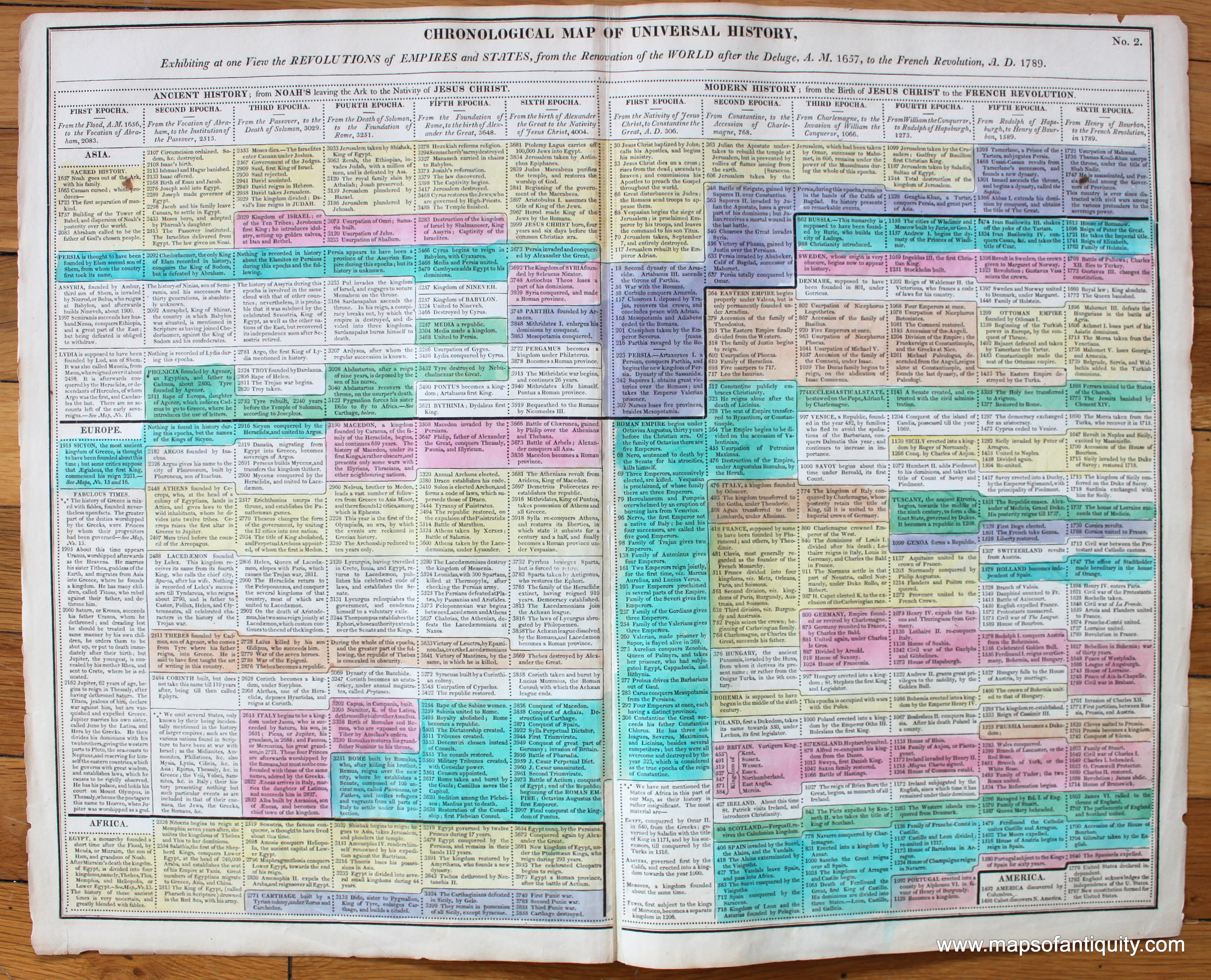
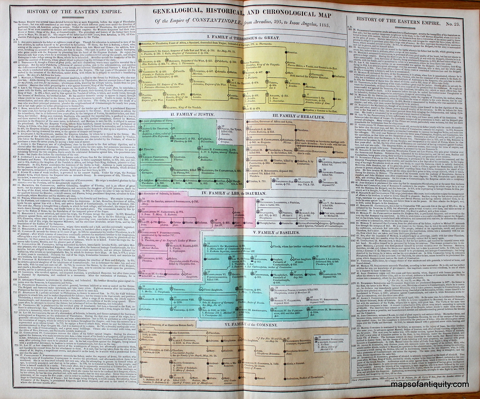
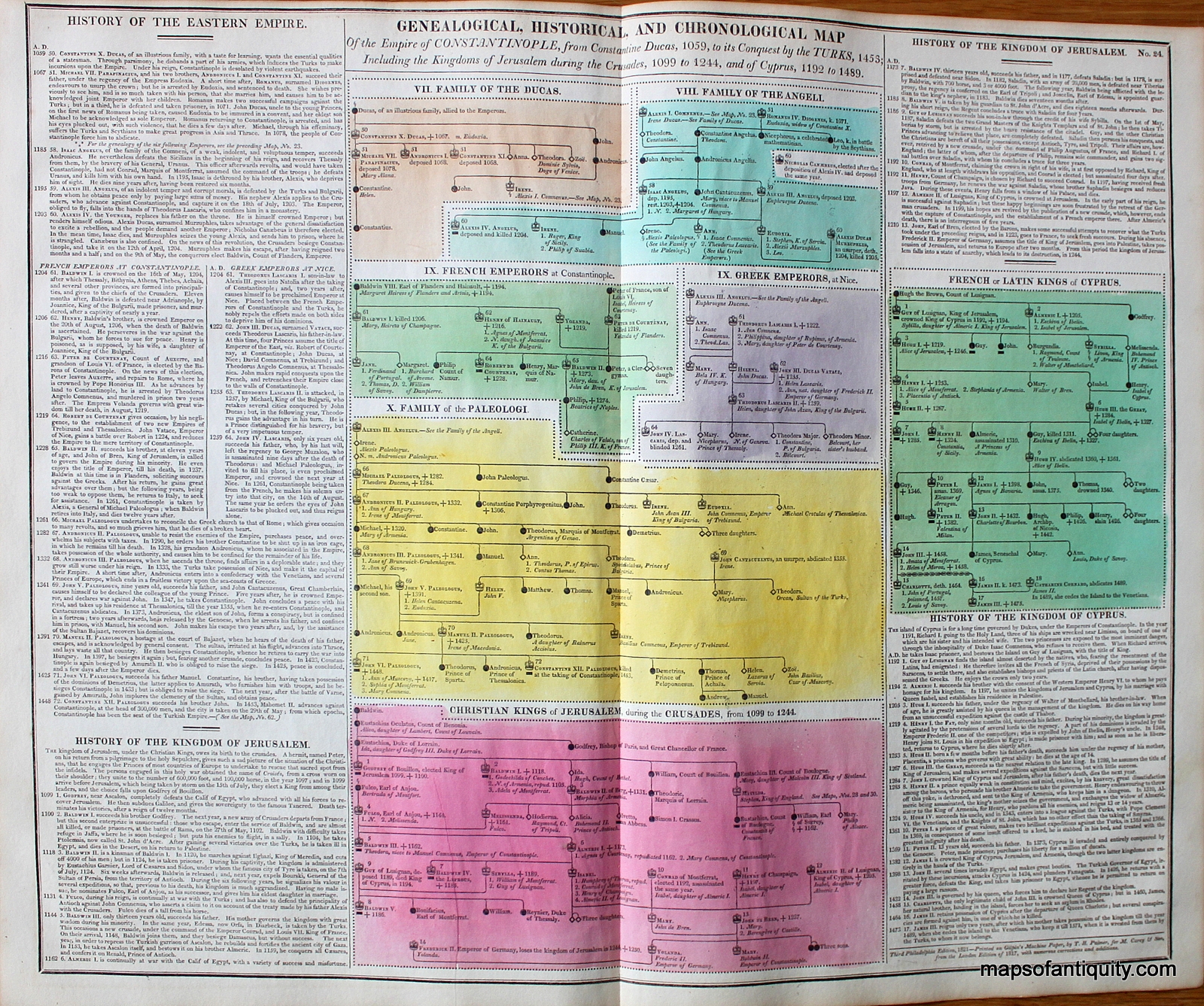
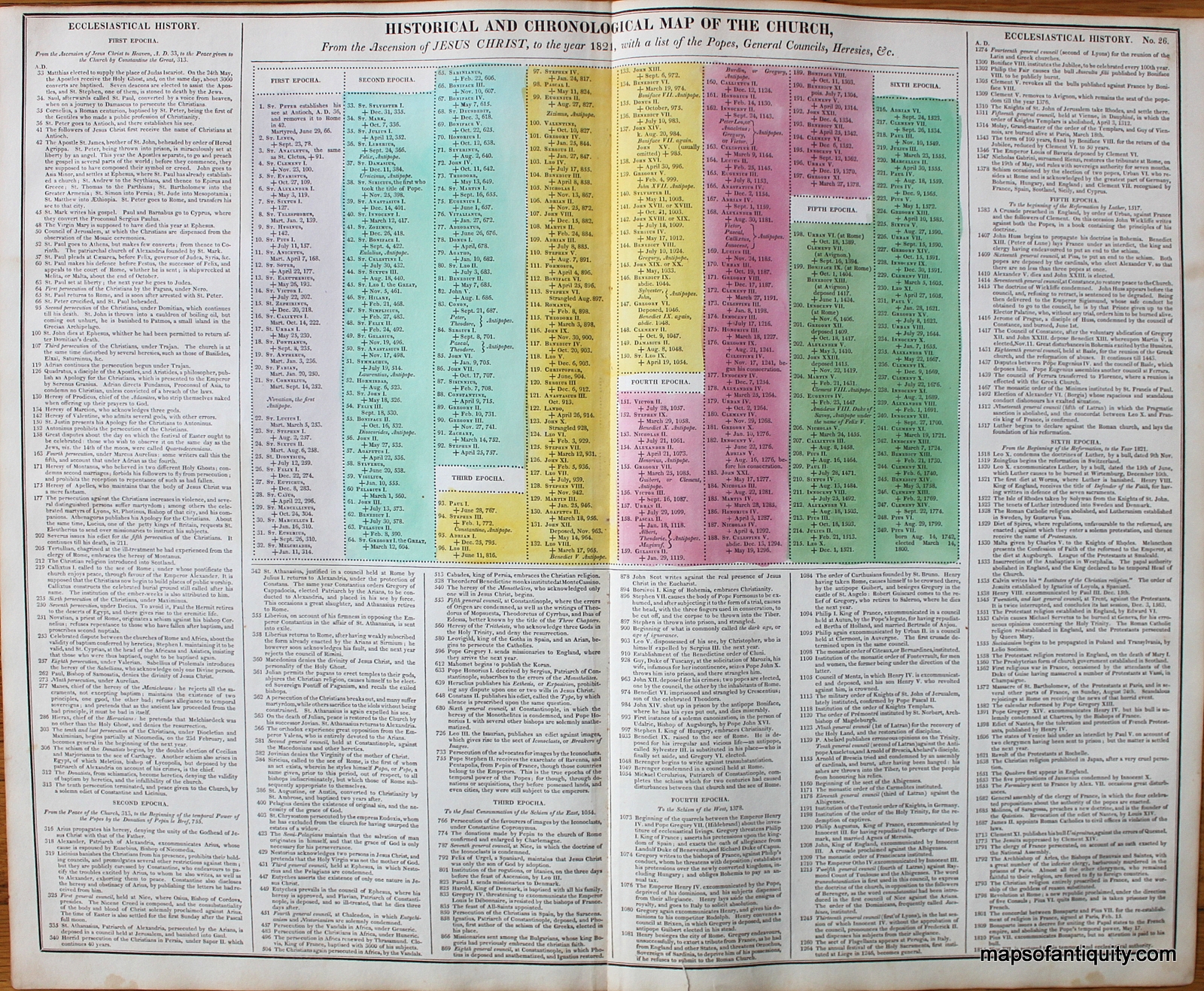
| EXHIBITING AT ONE VIEW THE REVOLUTIONS OF EMPIRES AND SATES, FROM THE RENOVATION OF THE WORLD AFTER THE DELUGE, A.M. 1657 TO THE FRENCH REVOLUTION, A.D. 1789 |
| Antique hand colored diagram “Exhibiting at one View the Revolutions of Empires and States, from the Renovation of the World after the Deluge, A. M. 1657, to the French Revolution, A. D. 1789,” drawn from the most recent Authorities for the Illustration of Lavoisne’s Atlas, published by Carey & Sons, timeline and detailed descriptions reviewing the revolution of the empires and states from 1657 to 1789, colorful and interesting descriptions of world history by continent. Good to very good overall antique condition with toning throughout, areas of noticeable foxing, some creasing/wrinkling, very mild tears at the outer edges of the paper, and minor seam separation at the center of the map. Total sheet dimensions are about 16 1/2″h x 20″w. |
https://upload.wikimedia.org/wikipedia/commons/7/71/Adams_Synchronological_Chart%2C_1881.jpg


